Terra Drone Indonesia’s LiDAR mapping UAVs are helping Palu recover from 2018 double disaster
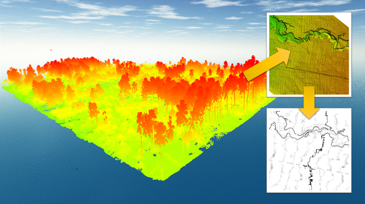
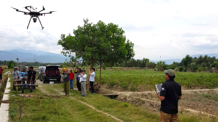
Sulawesi, Indonesia, May 15, 2019 – For the first time ever, Light Detection and Ranging technology (LiDAR) is being used to create maps for post-disaster recovery efforts in Indonesia. Terra Drone Indonesia, in collaboration with the Japan International Cooperation Agency (JICA), is using drone-mounted LiDAR technology and photogrammetry to create high-resolution maps of impacted areas.
For the city of Palu on the Indonesian island of Sulawesi, September 28, 2018, was a day of death and destruction. A powerful 7.5 magnitude earthquake struck the island and triggered a 3-meter-tall tsunami which swept away houses in Palu. The double disaster left the city facing a long and difficult road to recovery.
The earthquake and the tsunami led to changes in the surface area which meant there were regions which were no longer suitable for housing. For the remaining land, ownership needed to be established before new housing construction could begin. Basic amenities like water, power, and sewer services also needed to be reestablished – none of which could be achieved without accurate, high-resolution maps of the impacted areas.
But undertaking ground survey to create the map was both difficult and risky because many areas had become inaccessible and there was also a possibility of aftershocks. Therefore, using drones was the most viable solution to collect high-resolution imagery and data in the shortest possible time.
In March 2019, Terra Drone Indonesia surveyed around 750 hectares of land with LiDAR-equipped drones, while another 300 hectares were surveyed using photogrammetry techniques. The data and imagery collected from these surveys have been used to produce maps that clearly show the current land condition and identifies hotspots that have sustained the most damage. Using these maps, government authorities can plan for the rebuilding of houses and infrastructure in a safe and appropriate manner.

Michael Wishnu Wardana Siagian, Managing Director of Terra Drone Indonesia, said, “LiDAR technology owned by Terra Drone Indonesia can penetrate through dense vegetation, detect changes in the face of a region, and lead to the creation of detailed and accurate 3D surface models – at a cost which is two to three times cheaper than other similar technologies.”
In addition to post-disaster surveying and mapping, drones can also be effectively used for disaster risk management and mitigation by collecting pre-disaster surface information and capturing real-time imagery during disasters to guide relief agencies and aid government decision-making.
About Terra Drone Corporation
Terra Drone Corporation is one of the world’s largest industrial drone service companies with more than 500 employees, established in 2016. The company’s head office is located in Tokyo, Japan, with 20 branches globally throughout APAC, the European Union, and South America. Terra Drone provides innovative industrial drone technologies empowered with LiDAR and photogrammetric surveying methods for construction, electricity, energy, and oil and gas sectors. Terra Drone specializes in high-performance hardware, cutting-edge software, drone services, and drone traffic management systems (UTM).


