How Drones Are Transforming Big Data Analytics
Guest Post by Indiana Lee
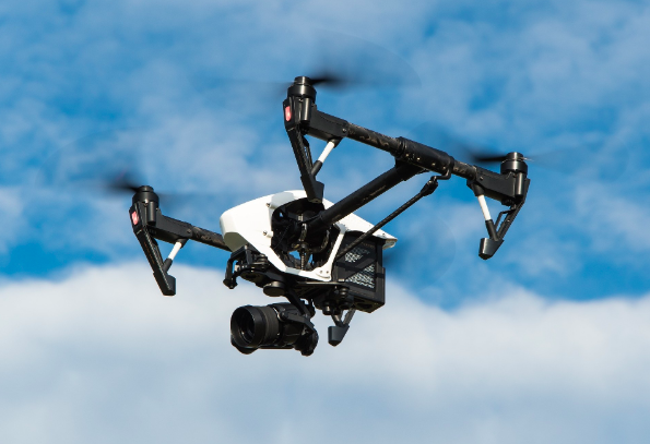
As more and more drones take to the skies to survey land, map neighborhoods, assess crops and monitor traffic, they are generating enormous amounts of data. The market for unmanned aerial vehicles, commonly referred to as drones, is expected to grow from $17.2 billion in 2017 to $48.9 billion by 2023, according to a report by Research and Markets.
Demand for big data for commercial uses, technological advancements, and increased venture capital funding will continue to drive rapid growth in drone use. Agriculture, real estate, construction, and highway safety are some of the industries analyzing this data. While drones are valued for the images and video footage they collect, they are increasingly able to store other types of information, including radio signals, soil moisture, factory emissions, and geodetic data, which includes precision measurements for land surveys.
Monitoring Agriculture
The market for drones is expected to be the hottest for use in agriculture, according to Research and Markets. Rather than traverse hundreds of thousands of acres by tractor or on foot, drones can quickly map out farmland. What areas will need more irrigation due to drought or are getting too much moisture because of poor drainage? Are there patterns of crop destruction? Are there crops that are faltering but might be saved by quick action? These and many more questions can often be more quickly and accurately answered at a lower cost by analyzing drone footage and data than by humans on the ground.
Collecting Public Health Data
Drones are also valuable in assessing public health threats. Because they are relatively low-flying, they aren’t hampered by clouds in spotting problems and collecting data. Drones are being used to aid in disaster recovery by appraising damage, searching for victims using not just video but thermal imaging to find hotspots, and looking for danger that can’t be spotted on the ground or in conditions too hazardous for humans. An example is assessing conditions after the earthquake in Japan that damaged the Fukushima Daiichi nuclear plant.
Drones can be used to fight wildfires, not just by dropping flame retardants but also by mapping out the extent of fires and likely areas they may jump to next. Aggregating drone information from car crashes can help computers determine predictions of the most dangerous areas and set in place measures to make them safer. Drones can also collect forensic evidence during traffic accidents and map out what happened, allowing authorities to be on the ground for a shorter period and roads to be reopened more quickly.
Construction and Real Estate
From mapping construction sites to individual properties, drones can also collect useful data for both construction forepersons and real estate agents. Drones can measure if building foundations are laid properly and to code as well as numerous other facets of construction. This data can be downloaded into the building management software used to oversee the entire construction project.
Mapping a home’s acreage, tree cover, outdoor features and footprint can easily be done by air. Drones can also provide aerial images for a realtor to use to help market a house. Big data comes into play when a real estate agency has dozens of listings. Using data derived from the drone, a real estate agent can quickly comb through information to select properties that best match a client’s requirements. In fact, a study shows that high-volume agents use drone photos to sell a house 3.5 times more often than ones who sell relatively few houses.
The study of 300 real estate listings valued at over $500,000 each found that drones were used most frequently (53% of the time) when the property was on two acres or more, giving buyers a chance to easily view the property in its entirety. House listings on under one acre used drone footage about 30% of the time. The study also found that the pricier the house, the more likely drone footage is used to market it.
A Growing Field
The reams of data being generated by drones aren’t helpful to anyone, though, unless there are humans who understand how to analyze it. The field of big data analytics is growing fast and is one of the highest-paying IT careers. Big data engineers implement systems to help their employers interpret data. Those in the field need expertise in coding and computer systems and have advanced math skills.
Between 2017 and 2020, big data analytics jobs were expected to grow to more than 2.7 million. Many of these jobs require advanced degrees. The Bureau of Labor Statistics forecasts computer and information technology jobs will grow 12 percent from 2018 to 2028, much faster than the average for all occupations, adding about 546,200 new jobs. One of the highest needs will be for workers with expertise in big data, according to the bureau.
Salaries for big data careers are increasing just as quickly. The 2020 Robert Half Salary Guide for technology jobs shows salaries in the bottom 25th percentile at $122,000 rising to $222,000 for those in the 95th percentile. The 2017 study reported a top salary of $196,000. The high salaries commanded by those in the field are driven in part by the new bounty of information collected by drones. Their commercial use in many fields, from agriculture to construction, is expected to continue to grow as drone technology becomes even more sophisticated in the capturing of data.
*Cover Image source: Pixabay
