What are the Steps for an Aerial Drone Survey?
Aerial drone surveying is a fast and accurate method of surveying terrain. But what can you expect when you begin an aerial drone surveying project? While there are intricacies depending on the land being surveyed, the process is mostly straightforward: planning, flight, processing, and data delivery. Here’s everything you need to know.
The Initial Planning
During the initial planning stages, the survey will be broken down into how much of the site will be surveyed, what the flight plan will be, what the timeline will be, and whether there are any potential weather concerns. The initial planning phase is very important, as it also outlines the expectations regarding the final deliverables.
If there are potential weather concerns, they may need to be scheduled around – and permits and licenses may also need to be acquired, depending on the location of the drone survey. The survey itself generally doesn’t take very long, so the planning stage will mostly do the preliminary work, make sure everything is prepped, and schedule the survey based on weather predictions.
Less planning is required for a drone survey than for other types of aerial survey. Planes and helicopters both require additional planning because a crew is involved, in addition to potentially needing specific permits to deploy an aircraft for any purpose. With a drone, weather and scheduling are usually the primary concerns.
Flight and Image Gathering
Weather permitting, the drone will follow a flight path and capture the appropriate images. Drones will either capture images through photogrammetric technology (which uses multiple color photographs) or LiDAR technology (which uses beams of lasers). Either way, the drone will collect enough information to successfully map the terrain below it.
Flight paths are designed so that the survey site is fully covered in the most efficient way possible, and one of the major benefits to drones is that they can capture high-resolution images by flying much closer to the ground than an airplane or helicopter can. A drone’s flight path can include areas that might otherwise be inaccessible, like canyons or urban environments, making it a critical technology for surveying difficult areas.
Most surveys can be completed in a single day, which means multiple flights won’t be required. If a site is particularly large, there may be several flights, and both battery power and range will also need to be considered – however, one of the chief advantages to a drone survey is that it’s one of the fastest methods of surveying.
Data Processing and Analysis
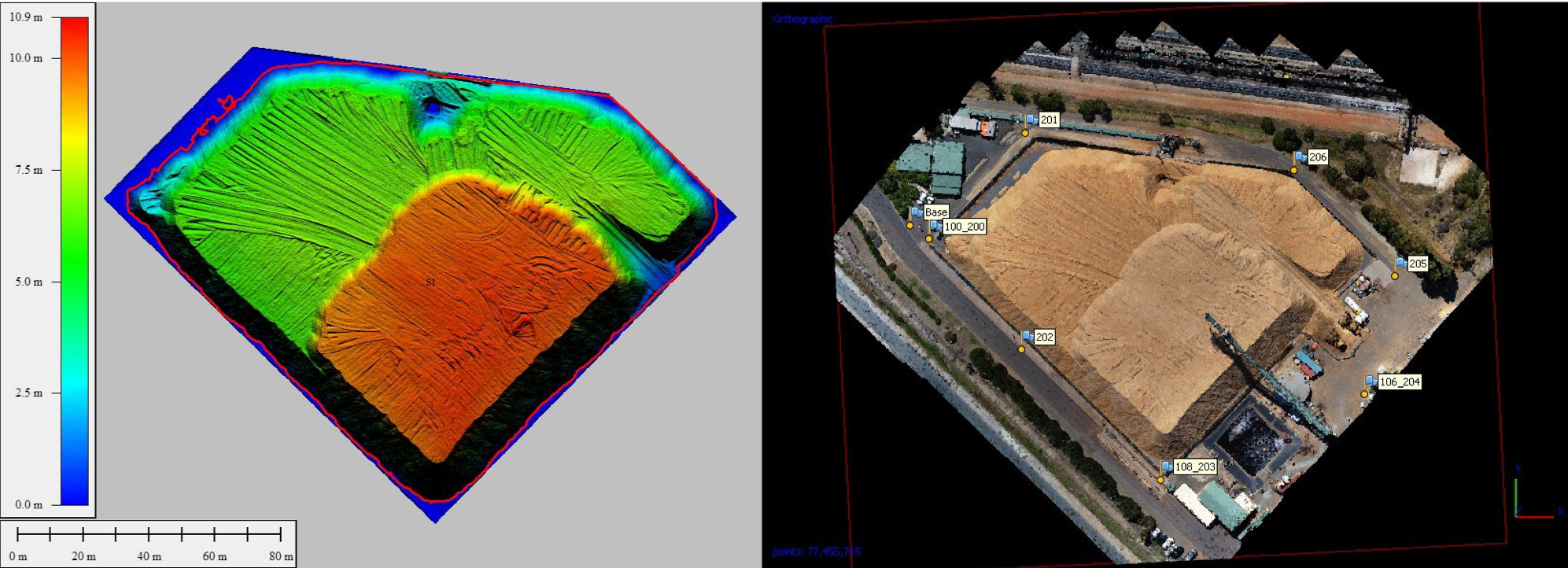
Once data has been collected, it needs to be processed, depending on the needs that were outlined during the initial planning stages. If only 2D imagery is required, then photogrammetric images will be stitched together to create a complete overview of the survey site. If 3D imagery is required, then the data collected will need to be analyzed, forming 3D models of the terrain.
Photogrammetric images can be used to create 3D models, but they need to be analyzed first. LiDAR technology provides high resolution 3D points, but some analysis may need to be done to provide human-readable content, such as by predicting the coloration of certain models, or differentiating human structures from organic structures.
Some companies perform their data processing and analysis in-house, while others outsource it to an analysis company. Outsourcing may make this stage take longer, as the surveying company will need to wait for the data to be returned.
Data Delivery
After being processed, data will be delivered to the client in the form of a final deliverable. Often, data may be held on a cloud-based server, so the client can connect with the data and view it easily from anywhere. Otherwise, the data may be sent directly to the client, so they can integrate it into their own existing systems. Regardless, the client has ultimate control over the final deliverable: they can request that the data be given to them raw or pre-processed.
Once the data is in the client’s hands, the client can then transfer it over to construction companies, architects, or other involved parties. Data can be used for simulation and planning purposes, depending on how the data has been provided. Often, a master copy of the data will be kept, so that any changes made won’t overwrite the initial data.
Once the data has been delivered to the client, the aerial drone survey is done: That’s all there is to it! For the client, the process will be fast and direct. Once the initial parameters of the survey have been discussed, the survey can be completed, and the data is furnished. Aerial survey data can be used for everything from preliminary land surveys to complex 3D simulations and modeling – and drone technology is growing and advancing every day.

Guest post by Dustin Price, a licensed land surveyor and the Operations Manager at Landpoint. He leads the company’s technical approach to delivering professional surveying services by providing tailored solutions using UAV technology.


